
# COVID-19 severity risk mapping
Mapping risk of severe COVID-19 disease
# Rationale
Individuals respond differently to infection with SARS-CoV-2 depending on a range of risk factors for severe disease. These include, but are not limited to, age, smoker status, hypertension, respiratory illness and weight. Understanding how these characteristics vary among a population, and where they cluster, is important for understanding which populations are particularly vulnerable to severe disease, which hospitals may become overburdened and which interventions should be prioritized.
# Our approach
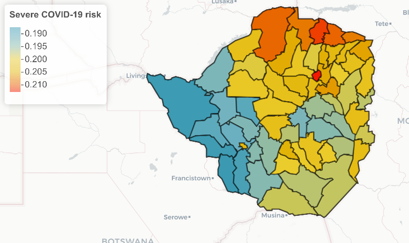
Using data from Demographic and Health Surveys, combined with our spatial prediction algorithms, we generate high resolution maps of several risk factors. We then combine these into a single estimate of risk using data from studies looking at risk factors for severe disease, such as Ma et al (opens new window).
# Where is this being applied?
We are working with the World Bank, who are support the Zimbabwe Ministry of Health's response to COVID-19, to map risk of severe COVID-19 at the district level.
Think this sounds useful?
You can reach us at hello@locational.io to ask any questions, request additions or changes, or arrange a demo. We are actively developing these algorithms and would like to hear from you.
← Risk mapping About →